
DGPS / GNSS Navigation Systems
Test your knowledge of modern satellite navigation systems .This quiz covers GPS, DGPS and GNSS fundamentals, including positioning accuracy, satellite signals, common errors, RAIM, HDOP, chart datums, and safe navigation practices. Designed for cadets, deck officers and maritime professionals.
नमूना प्रश्न
यहाँ इस क्विज़ के कुछ उदाहरण प्रश्न हैं। पूरा टेस्ट देने के लिए GYRO ऐप डाउनलोड करें।
प्रश्न 1
Global Navigation Satellite Systems (GNSS) provides three services known collectively as PNT, what are they?
प्रश्न 2
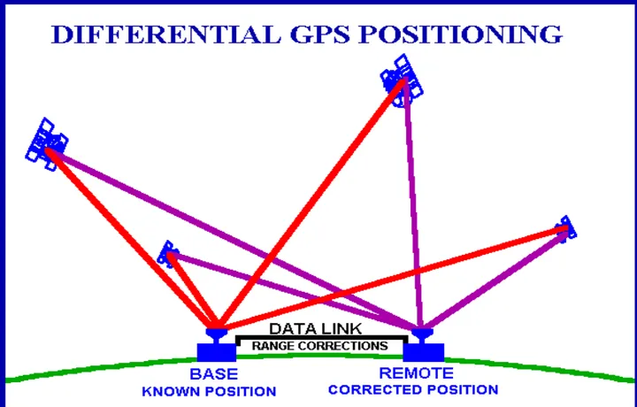
With reference to Navstar GPS system used in conjunction with a Differential Reference Station, on what is the accuracy of the resultant position mainly dependant?
प्रश्न 3
What datum is used by the HO approved vector charts, as used by the Navstar GPS system?
प्रश्न 4

GLONASS is an alternative to what system?
प्रश्न 5
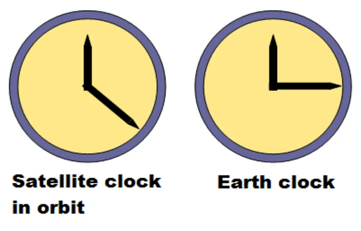
What is the reason for “clock error” with reference to the Navstar GPS system?